Then & Now: The Battle of the Bulge in Photographs
Introduction
The forests, villages, and fields of Belgium and Luxembourg witnessed some of the fiercest fighting of World War II during the Battle of the Bulge (December 1944 – January 1945). While much has changed in the 80 years since, traces of the battle still exist in the landscapes and towns.
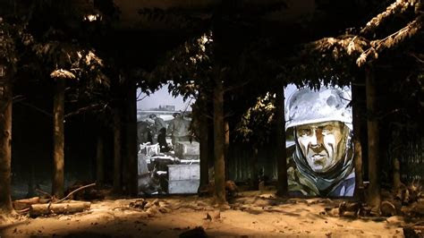
Through then-and-now photography, visitors can step directly into the past — aligning wartime images with the same places today. Churches rebuilt, tanks preserved, and foxholes still visible in the woods provide haunting juxtapositions of destruction and recovery.
This feature highlights some of the most striking comparisons you can recreate on your visit.
Bastogne: The Mardasson and Town Square
Then (1944–45): Bastogne was under siege, bombarded by artillery and cut off from supply lines. The town square bore the scars of heavy shelling, with destroyed buildings lining the cobblestones.
Now: The square is vibrant with cafés, shops, and the annual Nuts Weekend celebration. A photo taken today captures the same angles — only now filled with life, music, and remembrance.
Photo idea: Archival photo of Bastogne square in ruins (U.S. Army Signal Corps, public domain) vs. your photo from the same street corner today.La Gleize: The Tiger II Tank
Then: December 1944 — Kampfgruppe Peiper’s retreat ended in La Gleize. A massive Tiger II tank was abandoned when fuel ran out.
Now: That very same tank remains on display outside the December 44 Museum. Unlike most wartime vehicles, it has not been moved or restored beyond preservation, offering one of the most authentic “frozen in time” images of the battle.
Tiger II tank in La Gleize — preserved in the exact spot it was left in 1944.Bois Jacques: Easy Company’s Foxholes
Then: The men of Easy Company, 506th Parachute Infantry Regiment, dug into frozen ground near Bois Jacques forest. Wartime photographs show snow-covered trenches, bare trees, and exhausted soldiers.
Now: Many of those foxholes are still visible today, preserved in the forest near Bastogne. Visitors often photograph the same shallow pits — now surrounded by tall, regrown trees.
Photo idea: Archival image of 506th in their foxholes (public domain) vs. modern shot standing in one of the preserved foxholes.Clervaux Castle
Then: In late December 1944, Clervaux Castle was nearly destroyed during heavy fighting. Black-and-white photos show collapsed walls and rubble.
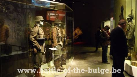
Now: The castle has been fully restored and houses the Museum of the Battle of the Ardennes. A side-by-side comparison of a wartime photo with today’s pristine façade reveals the resilience of the town.
Malmedy Town Center
Then: Malmedy was devastated by shelling, and the massacre of U.S. prisoners nearby remains one of the war’s darkest moments. Photos of the town show shattered buildings and rubble-strewn streets.
Now: Malmedy is a charming Ardennes town with rebuilt churches, squares, and cafés. Visitors can stand in the same spots as 1945 photographs and see both destruction and rebirth.
1) Bastogne — A besieged town that held
THEN (Wartime, PD)
- “Bastogne resupply, 26 Dec 1944” — U.S. Army Signal Corps (NARA) – Public Domain. Wikimedia Commons
NOW (Modern/Commemoration, PD)
- “Gen. Anthony McAuliffe’s Monument, Bastogne, 2009” — U.S. Army (federal work) – Public Domain. Wikimedia Commons
Download links
(then)
https://commons.wikimedia.org/wiki/File:Bastogne_resupply1944_sm.jpg
(now)
https://commons.wikimedia.org/wiki/File:Flickr_-_The_U.S._Army_-_Gen._Anthony_McAuliffe's_monument_in_Bastogne,_Belgium.jpg
Suggested credit
- U.S. Army Signal Corps, NARA – Public Domain.
- U.S. Army – Public Domain.
2) La Gleize — Tiger II and the end of Peiper’s push
THEN (Wartime, PD)
- “M7 105-mm SP Howitzer near La Gleize, 1944” — U.S. Army Center of Military History – Public Domain. Wikipedia
NOW (Modern, CC BY-SA)
- “Tiger II at La Gleize (2021)” — Hoebele, CC BY-SA 4.0. Wikimedia Commons
Suggested credit
- U.S. Army CMH – Public Domain.
- Hoebele via Wikimedia Commons – CC BY-SA 4.0.
3) Bois Jacques (near Bastogne) — Easy Company’s foxholes
THEN (Wartime context, PD)
- “Bastogne 1944 (U.S. Army CMH)” — Public Domain. Wikimedia Commons
- “101st Airborne in Bastogne, Christmas 1944” — U.S. Army Signal Corps, PD. Wikimedia Commons
NOW (Modern, PD)
- “Foxholes — Bois Jacques, Bastogne (2015)” — Bel Adone, Public Domain. Wikimedia Commons
Suggested credit
- U.S. Army CMH / Signal Corps – Public Domain.
- Bel Adone via Wikimedia Commons – Public Domain.
4) Clervaux Castle (Luxembourg) — from ruins to restoration
THEN (Wartime/Post-battle, PD)
- Clervaux, Luxembourg (U.S. Army CMH image) — Public Domain. Wikimedia Commons
NOW (Modern, CC BY-SA)
- “0 Château de Clervaux (1).JPG” — CC BY-SA, Wikimedia Commons. Wikimedia Commons Category
Suggested credit
- U.S. Army CMH – Public Domain.
- Wikimedia Commons contributor – CC BY-SA.
5) Malmedy — devastation and renewal
THEN (Wartime, PD)
- “Malmedy (LOC LCCN2004661783)” — Library of Congress – Public Domain. Wikimedia Commons
NOW (Modern, CC BY-SA)
- “Malmedy, City (2008)” — Duhon, CC BY-SA. Wikimedia Commons
Suggested credit
- Library of Congress – Public Domain.
- Duhon via Wikimedia Commons – CC BY-SA.
How to place these on your page
- Put the wartime photo on the left and the modern on the right.
- Under each pair, add a small caption + credit, e.g.:
Bastogne: C-47 supply drop, Dec 26, 1944 (U.S. Army Signal Corps, PD) vs. McAuliffe Monument, Bastogne (U.S. Army, PD).
- For CC BY-SA images, include the author name shown on the Commons page and a link to the file page.